

2015: The Sag River Saga
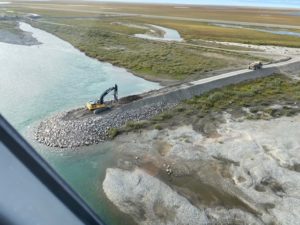
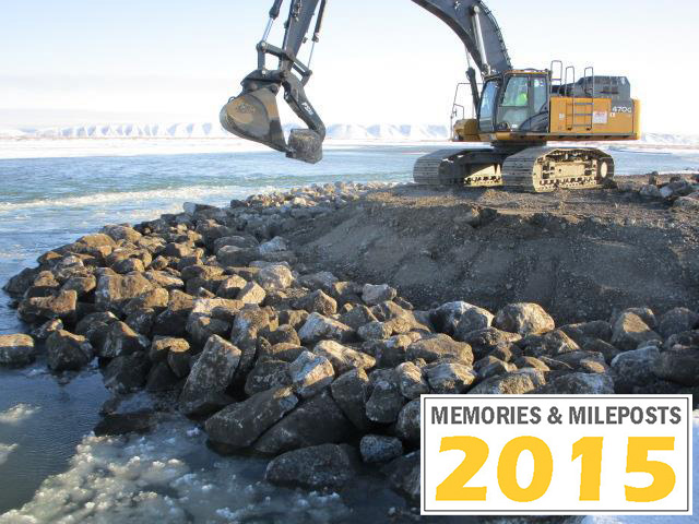 Waterways along TAPS are often turbulent and changing, and they pose challenges each spring as Alaska transitions into summer. The Sagavanirktok (Sag) River is no exception. While it has presented Alyeska’s Rivers and Floodplains Program with repair work over the years, 2015 was the starting cycle of extensive aufeis and major flooding in the northern region of TAPS that hadn’t been witnessed before. Since 2015, increased data collection and monitoring has further helped forecast focus areas for preventing damage to the pipe and the Dalton Highway.
2015
Prior to 2015, Alyeska mostly saw a quieter Sag River. Flood repair is an annual task along TAPS, and other waterways of concern include the Dietrich River, Middle Fork Koyukuk, and waterways on the southern end of TAPS, like Tazlina and Lowe Rivers.
The efforts to repair flooding along the Sag have been recognized several times through Alyeska’s Atigun Awards, an employee recognition program that acknowledges exemplary work. Here are a few summaries of work and response since 2015:
- 2015 Atigun Award spotlight – Environment, Flood response teams
- 2016 Atigun Award spotlight – Teamwork, Sag River flooding response
- 2020 Atigun Awards, Teamwork – Sag River project
Mutual benefit to maintain the Dalton Highway
Warmer temperatures have impacted flooding along the Sag in recent years, and Alyeska has upgraded all affected structures in response to changing climate to withstand new conditions. A collaborative effort exists with the University of Alaska Fairbanks (UAF), Department of Transportation (DOT) and the National Oceanic and Atmospheric Administration (NOAA) to collect and share hydrological data along the northern half of Alaska to help monitor trends, forecast, and adapt to changes. Each year, these groups gather to share data and assessments as spring arrives.
In 2015, the Dalton Highway and TAPS were at risk with three weeks of major flooding. With the Dalton being the main road connection between Deadhorse to Fairbanks, oil field operations and employees were preparing for strains on project deadlines and shortages on food, fuel and other products needed to run industrial facilities.
“Everyone along the North Slope had to think about rationing,” said Alex Lai, Alyeska Senior Integrity Engineer. “You could only fly up so many supplies, but airlifting is an option for only so many items and limited by size and weight”.
Lai recently summarized the joint effort between Alyeska and DOT to protect infrastructure.
“The Dalton serves a great purpose besides being part of the road system. It also serves for us as a berm that protects parts of the fuel gas line and TAPS.”
The solution was to raise the affected spur dikes along with the adjacent highway. After back-and-forth discussions, the height was settled. The Dalton had to be slightly higher than the spur dikes, anything else would risk flooding over the Dalton in the future, exposing sections of the system – such as the fuel gas line and shallow-buried pipe. Some sections of the highway near Deadhorse had to be raised up to seven feet.
Lai credits Alyeska leadership for their continued decision to prioritize preventative work in flood-prone areas.
“We’ve done very well as a company to be responsive and provide resources as we look ahead each year for challenge areas,” said Lai. “We are in good shape with our risk reduction emphasis, monitoring program and expanding collaboration between UAF, DOT and NOAA.”
All affected flood-prevention structures have since been upgraded in response to withstand new conditions. While Alyeska was in repair mode during 2015 and years after, the Rivers and Floodplain Program maintained proactive measures to reduce risk.
Ann Marie White, Alyeska Systemwide Maintenance Senior Manager, recognized that many contractor teams that work on TAPS on both preventative and response work from flooding. She expanded on the annual repair and proactive work that goes on along the Sag.
“We know that emergency repairs are a potential each year,” said White. “With our proactive structures in place, we’re protecting TAPS’ infrastructure with spur dikes that are intended to get damaged, bear the brunt of a flood but ultimately reduce the ground from washing away and impacting TAPS.”
A history of surveying, a future of data-driven decision making
Lai constantly works toward improving Alyeska’s response and preparedness for each flood season and feels that he’s working with a system that has stood a long test of time: “Our Owners got the best of the best for river engineering at the time. Whenever we face a big flood, I’m reminded of their work. I give a lot of credit to the original designers of the pipeline who had very little data to work with. They made robust design on a small amount of historical data, and with new technology that helps us monitor water/snow levels and other meteorological data, we are better equipped to predict challenging areas of over 100 miles of pipe that exist on floodplains and flood-prone areas.
Each year, Lai partners with one of the original TAPS design engineers, Wim Veldman, to perform a weeklong, extensive joint assessment fly-over and ground surveillance. Veldman was one of the original field engineers that oversaw the installations and design over river crossings, and Lai values his opinion.
“Wim brings the historical perspective, he understands the risks and variables to consider that could impact stream behavior, such as how the waterways may react during a flood,” said Lai. “It’s always good when assessing rivers and basins to have a second set of eyes. We challenge each other’s ideas, assumptions and assessments, but these trips, along with the data collected with our other partners produces the best preparation for flooding season.”
As Alyeska celebrates 45 years of TAPS operations, the current teams involved in flood monitoring and repair are always learning from the past and adapting to a changing environment. Their diligent work builds confidence in the ability of our infrastructure to meet the next set of challenges in this dynamic environment.
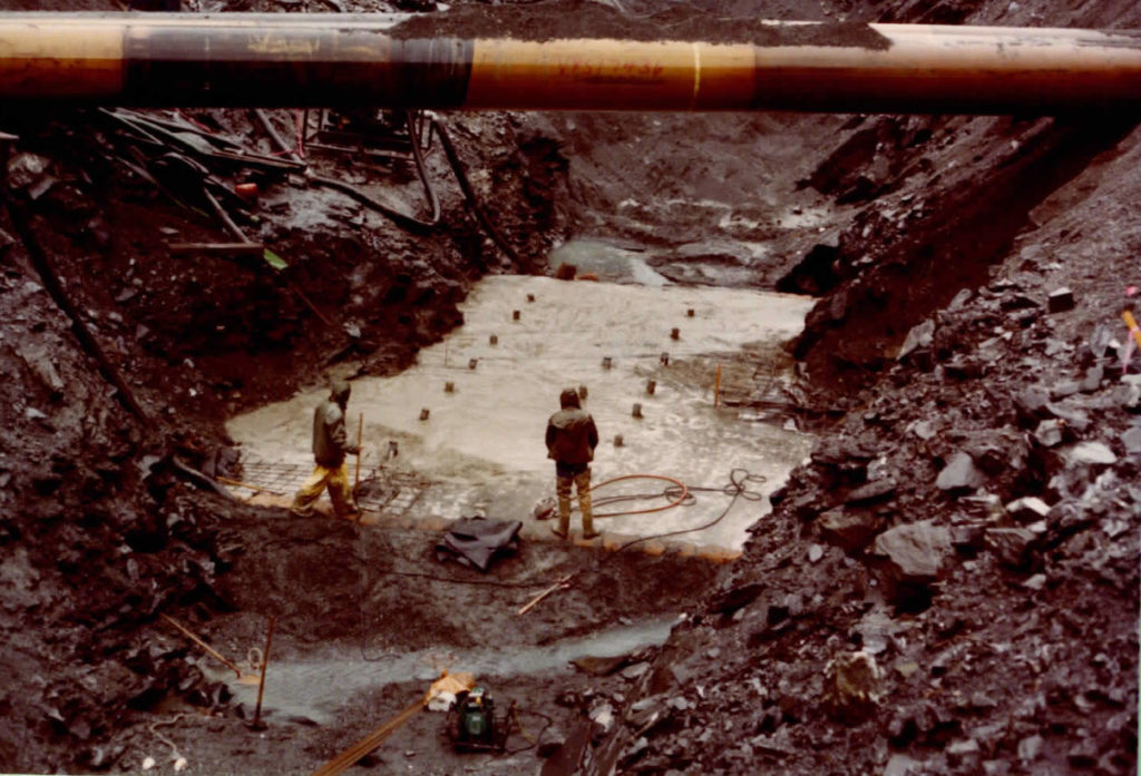
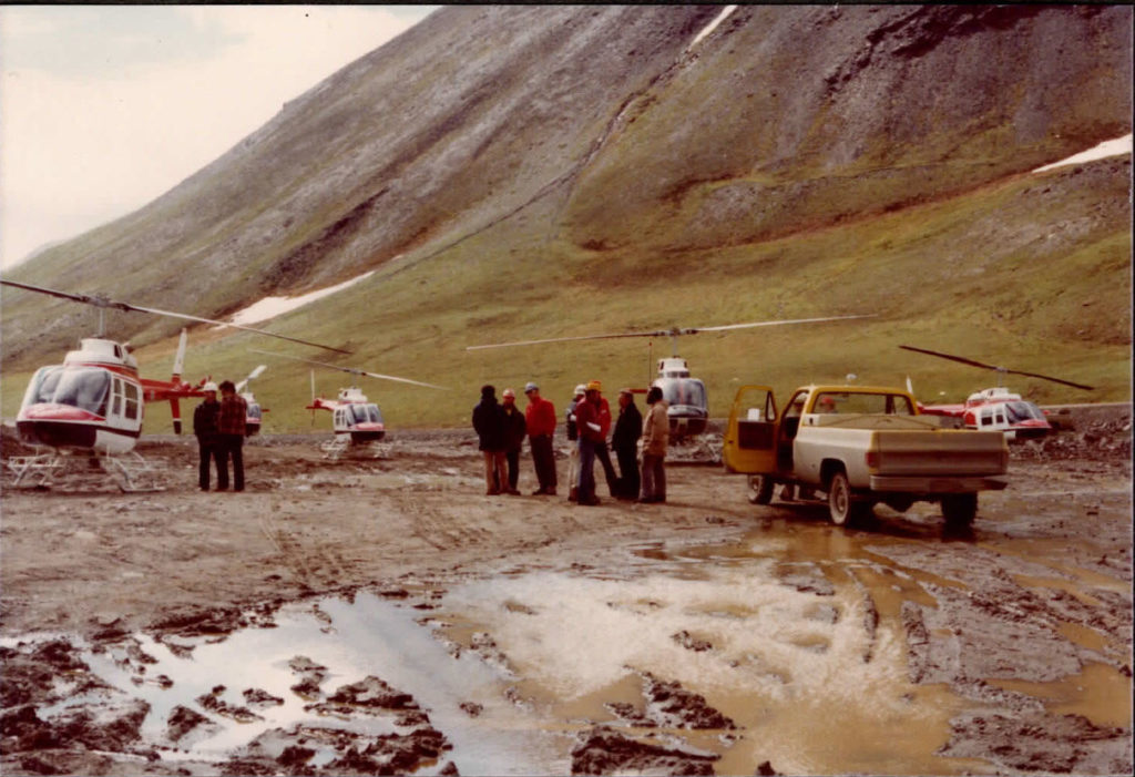
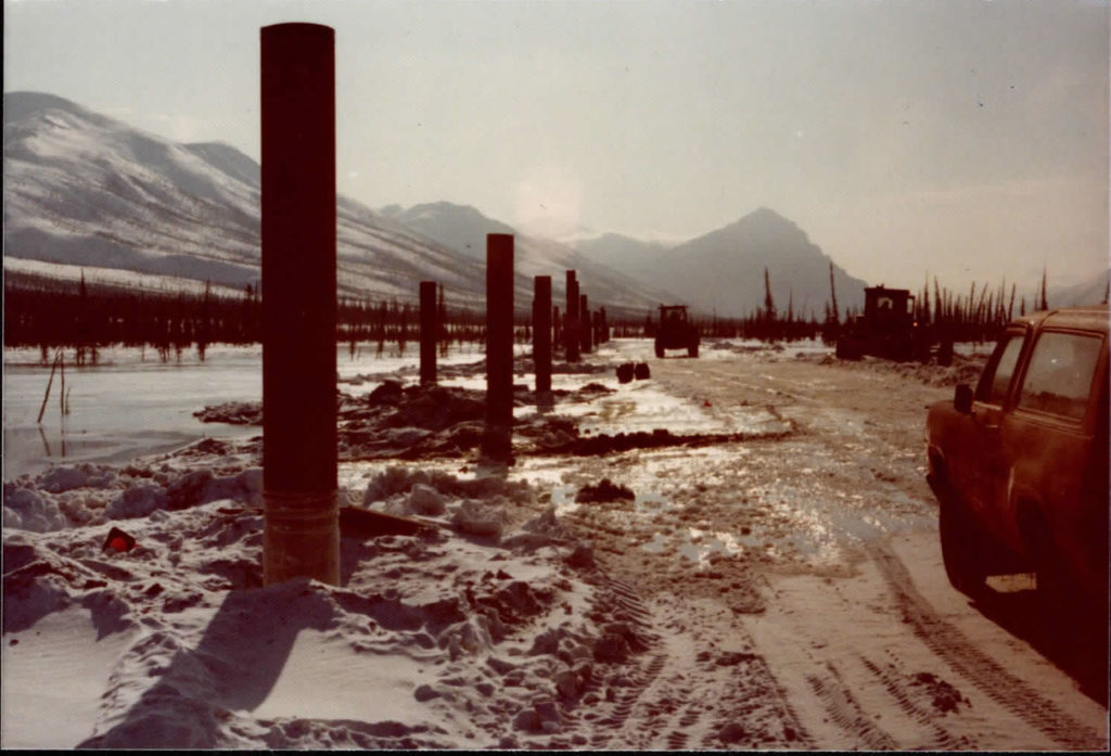
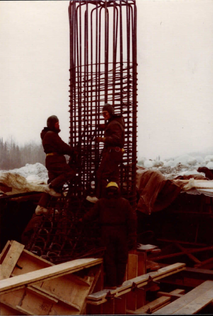
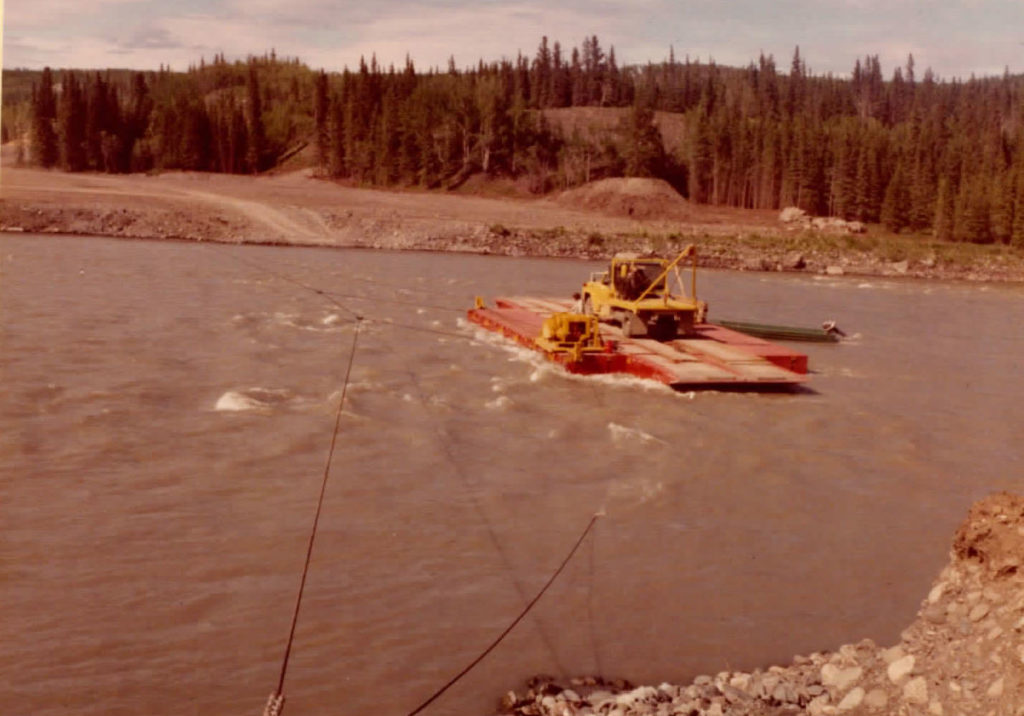
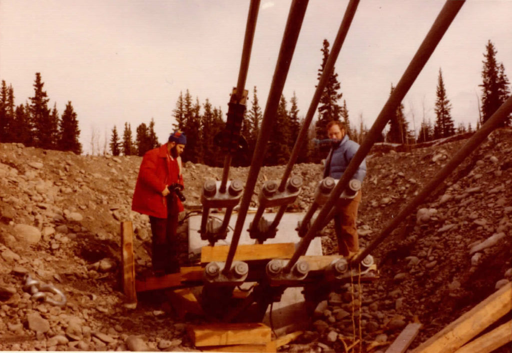
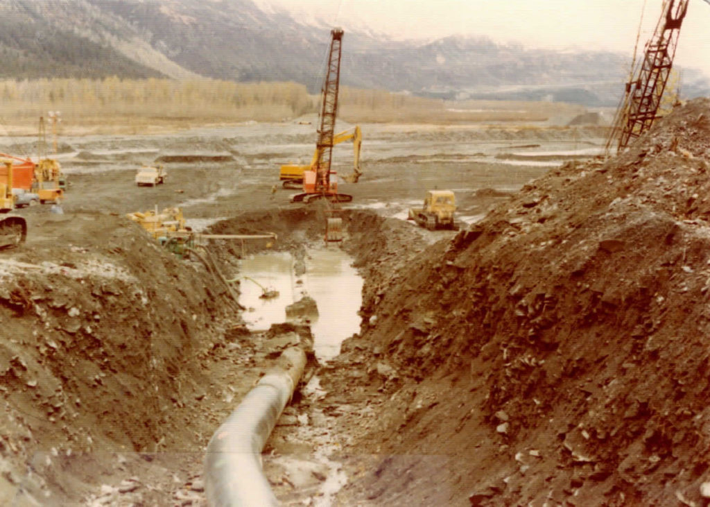
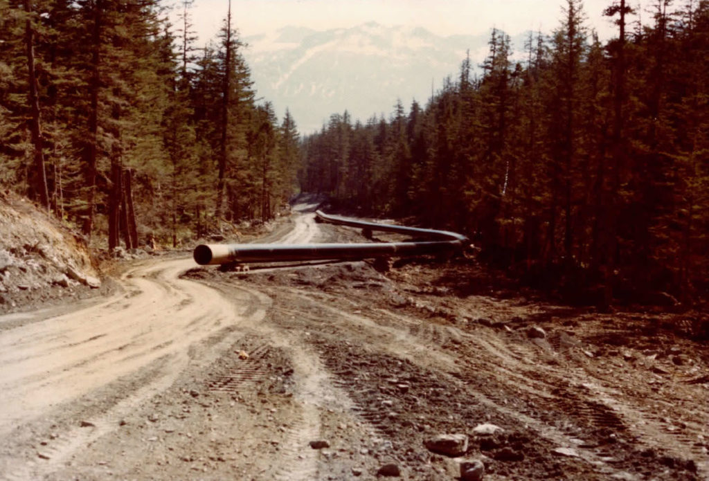
Scroll down to see Historical photos of river crossings, flood plain work and more on TAPS.
READ MORE 45TH ANNIVERSARY THE EVOLUTION OF TAPS STORIES:
1991: Atigun Pass mainline reroute
2007: Operations Control Center moves from Valdez to Anchorage
2013: With straight pipe installed, PS10 demobilization complete